
District seat is Sárvár
Its surface area is 685.46 km²
Population: 37,867
Settlement structure:
The population number identified per settlement points to the strong fragmentation of the settlement structure. Of the 37,867 inhabitants of the district consisting of 42 settlements, 37.8% live in Sárvár, the remaining 62.2% “share” 41 settlements with an average of 574 people, which is approximately 1/25th of the population of Sárvár. Répcelak also has a population of only 2,482 people, which as a second city means approximately 1/6 size compared to Sárvár.
| Total | Male | Female | |
|---|---|---|---|
| Sárvár district | 37 867 | 18 240 | 19 627 |
| Bejcgyertyános | 425 | 205 | 220 |
| Bő | 715 | 367 | 348 |
| Bögöt | 386 | 196 | 190 |
| Bögöte | 308 | 151 | 157 |
| Chernelházadamonya | 216 | 114 | 102 |
| Csánig | 345 | 170 | 175 |
| Csénye | 685 | 336 | 349 |
| Gérce | 1 099 | 534 | 565 |
| Gór | 333 | 172 | 161 |
| Hegyfalu | 755 | 360 | 395 |
| Hosszúpereszteg | 642 | 305 | 337 |
| Ikervár | 1 632 | 800 | 832 |
| Jákfa | 489 | 246 | 243 |
| Káld | 1 019 | 487 | 532 |
| Kenéz | 268 | 131 | 137 |
| Megyehíd | 318 | 152 | 166 |
| Meggyeskovácsi | 716 | 371 | 345 |
| Mesterháza | 146 | 71 | 75 |
| Nagygeresd | 248 | 121 | 127 |
| Nemesládony | 160 | 77 | 83 |
| Nick | 559 | 278 | 281 |
| Nyőgér | 326 | 163 | 163 |
| Ölbő | 685 | 326 | 359 |
| Pecöl | 731 | 361 | 370 |
| Porpác | 158 | 76 | 82 |
| Pósfa | 261 | 140 | 121 |
| Rábapaty | 1 710 | 858 | 852 |
| Répcelak | 2 482 | 1 183 | 1 299 |
| Répceszentgyörgy | 134 | 65 | 69 |
| Sajtoskál | 356 | 176 | 180 |
| Sárvár | 14 314 | 6 682 | 7 632 |
| Simaság | 566 | 281 | 285 |
| Sitke | 703 | 349 | 354 |
| Sótony | 609 | 314 | 295 |
| Szeleste | 651 | 324 | 327 |
| Tompaládony | 325 | 164 | 161 |
| Uraiújfalu | 835 | 400 | 435 |
| Vámoscsalád | 287 | 142 | 145 |
| Vásárosmiske | 350 | 163 | 187 |
| Vasegerszeg | 342 | 157 | 185 |
| Vashosszúfalu | 377 | 175 | 202 |
| Zsédeny | 201 | 97 | 104 |
Economic activity of the population at district level
(Source: HCSO database; Vas County Government Office database)
| Category | Sárvár District | |
|---|---|---|
| main | Share within population | |
| Total population | 37 867 | 100,0% |
| This | ||
| Employed | 19 526 | 51,6% |
| Unemployed | 556 | 1,5% |
| Receiving inactive | 9 758 | 25,8% |
| Dependant | 3 022 | 8,0% |
| Person under 15 years | 5 005 | 13,2% |
| Additional data on unemployed persons[1] | ||
| Number of unemployed | 555 | 1,47% |
| Unemployed and employed ratio | 2,84% | |
| Number of unemployed people with vocational qualifications | 353 | 0,93% |
| Ratio of unemployed people with vocational qualifications and employed persons | 1,81% | |
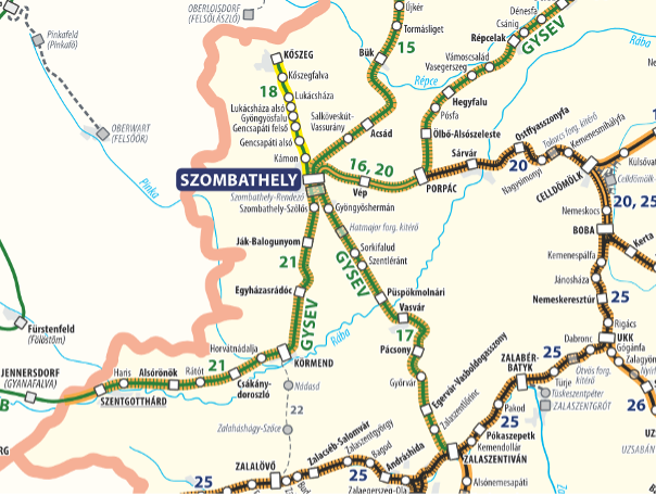
The transport conditions of the Sárvár district can be considered adequate within Vas County, both towns of the district have good transport conditions in terms of regional accessibility.
Sárvár, as the seat of the district, is located at the intersection of the main roads running East-West and North-South in terms of road traffic. Main road 84 still retains its tourist significance through the Sopron-Balaton axis. A bypass road surrounds the city from the North, which significantly facilitates the logistical possibilities related to various points of the settlement. In addition, the Hungarian motorway network is easily accessible from Sárvár via a straight-lined 11-km-long road at the junction of Hegyfalu M86.
In terms of road transport, Répcelak is located in the immediate vicinity of the M86 highway, with its own exit. This is definitely a positive feature. However, it should also be taken into account that it does not have significant road links at regional level.
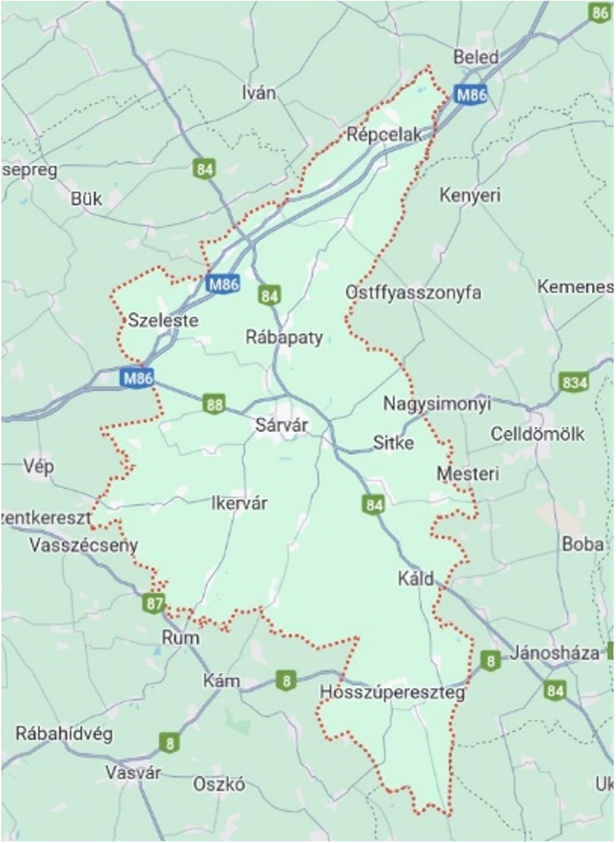
In terms of rail transport, Sárvár is located on timetable line 20 connecting Szombathely with Székesfehérvár, and from there with direct onward travel to Budapest, which makes rail passenger and freight transport directly accessible from East to West.
Répcelak is located on timetable line 16, which connects Szombathely with Csorna, and from there with Győr and Budapest.
Both towns of the district can be reached within 30 minutes by road and rail from Szombathely, the county seat of Vas County.

2024. Minden jog fenntartva.
A honlap fejlesztése a Nemzetgazdasági Minisztérium támogatásával valósult meg. Támogatói okirat: VF/44/5/2023’.